
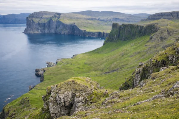
Hiking in the Faroe Islands takes you through dramatic coastal landscapes of steep green cliffs, rolling hills, and windswept valleys. Trails climb above tiny seaside villages like Gjógv and open onto sweeping views of the North Atlantic crashing against towering sea stacks. Along the way you pass waterfalls spilling into the ocean, grazing sheep on open slopes, and ridgelines that seem to disappear into the clouds. With its raw coastal beauty, shifting light, and powerful ocean scenery, hiking in the Faroe Islands feels wild, remote, and unforgettable.
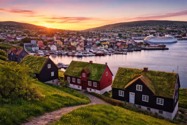
Your adventure begins as you arrive in the Faroe Islands, where transport will be arranged to collect you from Torshavn Airport and take you to the accommodation. On the first day you’ll have time to settle in and it’s a great opportunity to meet your fellow adventurers. We can also recommend accommodation for the night before if you plan to arrive earlier. Torshavn will be the base for the whole trip, which is great because you don’t need to carry all your stuff around and after a long day walking you know your warm shower and bed is awaiting you.
Click for Route Map : 10 km 4–5 h ~500 m ●●●○○ — Moderate
From the first steps, this route offers open views over Eysturoy, south toward Tórshavn, and out to the island of Koltur. The path climbs gently toward the small mountain pond at Sundshálsur before reaching the broad pass of Reiðskarð — also known as Norðarskarð in Syðradal — where the grassy trail is marked by cairns and easy underfoot.
From here, descend into Syðradal along a new farm road, cross the Breiðá river, and follow a line of red-topped poles toward Norðradal. The trail narrows through Tungulið pass, where cliffs drop steeply to the surf below and deep gullies cut into the hillside. Koltur’s distinctive profile appears ahead, standing sentinel in the sea.
Beyond the stone gate at Norðradal, you can add a short detour into Dalagjógv gorge, a dramatic cleft with a narrow ledge, before continuing into Sunnarabotn. The climb steepens up Rossarygg ridge, a natural viewpoint tied to an old local legend about a priest’s fateful journey — a story that gives Lýsnarskarð, or “Light Pass,” its name.
The final stretch to Sunnarskarð opens onto a sweeping panorama of Kallbaksfjørður and the eastern peaks of Eysturoy. From here, the walk eases into a flat, stony track leading back across the high ground to Sundshálsur.
Click for Route Map : 12 km 4–5 h ~750 m ●●●●○ — Challenging
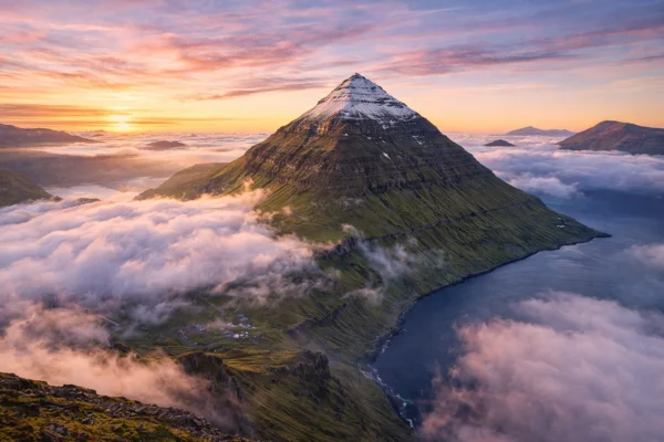
This iconic mountain trail begins near the pass of Eiðisskarð, between the villages of Eiði and Funningur, gradually ascending towards the majestic peak of Slættaratindur – the highest point in the Faroe Islands at 880 metres.
The route follows a well-trodden but natural path up the mountainside, flanked by mossy heather and weather-sculpted stones. As you climb higher, the silence is only broken by the call of seabirds riding the thermals and the distant bleating of sheep below. On clear days, the summit offers a breathtaking 360-degree panorama – from the jagged stacks of Risin og Kellingin near Eiði to the fjords around Funningur, and far beyond to all 18 islands.
Local lore whispers that giants once wandered here, and standing at the top, it’s easy to see why – the wind, the vast sky, and the endless sea create a mythical atmosphere.
The hike is an out-and-back route, and although it’s not technically difficult, the steepness and rapidly changing weather mean it’s best done in stable conditions.
Click for Route Map : 8–9 km 5–6 h ~750 m ●●●●○ — Challenging
From the village of Viðareiði on the northern tip of Viðoy, the trail climbs steeply up grassy slopes toward Villingadalsfjall (841 m), one of the highest peaks in the Faroe Islands. The ascent is demanding, often on rough and exposed ground, but the views quickly widen across the northern isles.
From the ridge, the path continues toward Cape Enniberg, the world’s second-highest sea cliff at 754 m. The panorama takes in sheer vertical walls dropping into the Atlantic, bird colonies nesting on the ledges, and expansive views across the archipelago.
The return follows the same route back down to Viðareiði, with constant sea and mountain vistas. Due to steepness, loose sections, and exposure near the cliffs, this hike is only recommended in stable weather and with care on the descent.
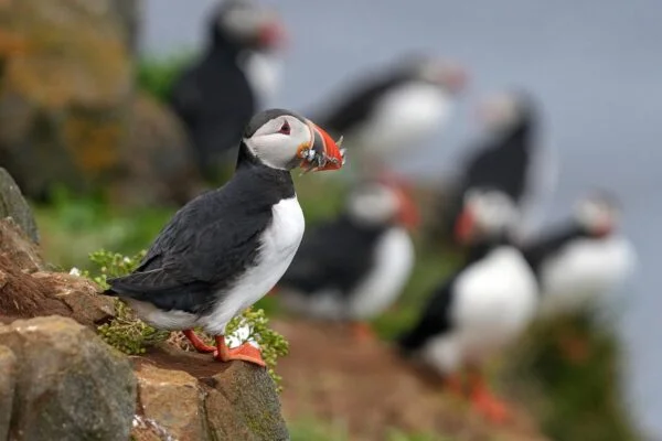
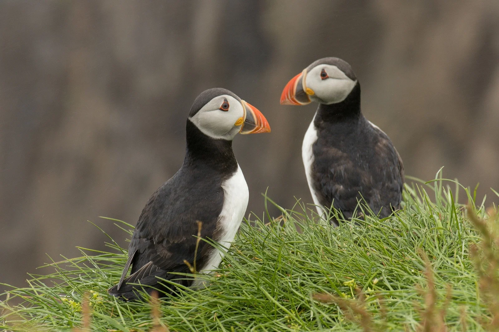
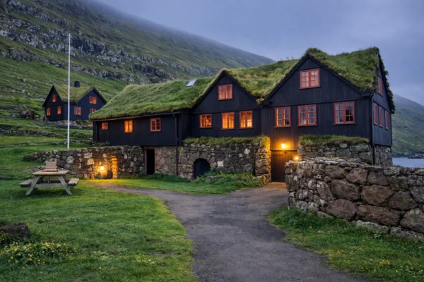
On a free day in the Faroe Islands without hiking, you could base yourself in Tórshavn and wander the old town of Tinganes with its turf-roofed houses, visit the Nordic House for exhibitions, and enjoy coffee or local craft beer by the harbour. A scenic drive makes a perfect contrast, taking you north through Kirkjubøur with its medieval ruins, on to Saksun with its tidal lagoon, and further to the colourful village of Gjógv with its dramatic sea gorge. Along the way you pass fjords, mountain tunnels, and plenty of photo stops. For a different perspective, you might book a boat trip from Vestmanna to see towering bird cliffs alive with puffins and fulmars, or simply enjoy Faroese culture through food — fresh seafood, traditional ræst lamb, and local beer. Between villages, museums, cosy cafés, and shifting seascapes, a no-hike day in the Faroes can be just as rewarding as time on the trails.
Click for Route Map : 11 km 4–5 h ~300 m ●●●○○ — Moderate
A short ferry ride from Tórshavn brings you to the island of Nólsoy, where the hike begins in the village and heads across rolling grassy hills. The trail leads toward the headland at Borðan, home to the historic Nólsoy lighthouse, which has guided North Atlantic shipping since the 19th century.
The route combines coastal tracks, sheep pastures, and gentle ridges with wide views back to Streymoy, Eysturoy, and across the open sea. Along the way you may spot seabirds, wildflowers, and the remains of old turf structures that speak to the island’s history.
The return follows the same scenic paths, looping back toward the harbour and village cafés, making this an accessible but rewarding half-day excursion that mixes Faroese culture with expansive coastal scenery.
Click for Route Map : 7–8 km 4–5 h ~400 m ●●●○○ — Moderate
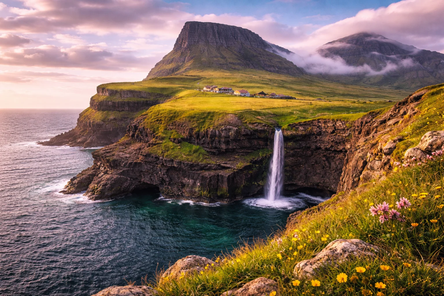
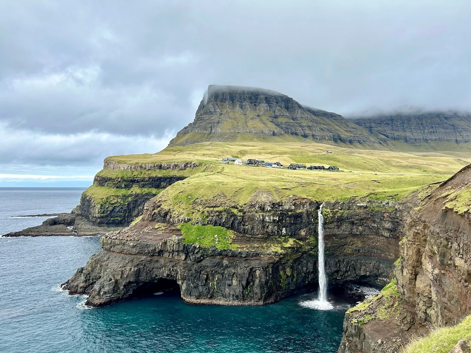
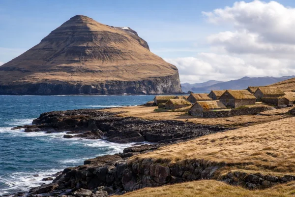
Beginning in the famous village of Gásadalur, known for its waterfall tumbling directly into the Atlantic, this trail climbs out of the valley and follows old shepherd paths across grassy ridges toward the remote northern coast of Vágar. The destination is Víkar, an abandoned hamlet that once clung to the cliffs, long since left to the winds and seabirds.
The route offers dramatic views over steep sea cliffs, offshore stacks, and the neighbouring island of Mykines. The terrain is a mix of heather, boggy ground, and exposed slopes, with cairns marking the way. Little remains of Víkar beyond stone walls and foundations, but the sense of isolation and history is striking.
The return follows the same route back to Gásadalur, making this a day hike that blends Faroese natural drama with the poignancy of a vanished settlement.
It’s time to pack your bags and move onwards. We arrange transport back to the airport so you can catch your flight home or continue to explore this majestical island. We have lots of recommendations if you’re going to spend more time in the Faroe Islands.
What's Included
- Accommodation (Twin Room)
- Airport Transfers
- Expert Guided Hikes
- Restaurant
- Transport to and from Hikes
- Hiking Friends
Additional Info
Accommodation – Hotel Brandan, Torshavn
Meeting Point – Arrivals Hall at Vagar Airport, Sorvagur
Transfer Details – Individual transfers can be any time on the first and last day.
Max Group Size – 12
Difficulty – On all our Trailmates trips you should have a good level of fitness. You don’t need to be an expert hiker but walks can be long with elevation. When possible we try to offer alternative options for those who want an easier day.
Dates & Prices
-
Early Bird DiscountSaturdayMay 8, 2027SaturdayMay 15, 2027£2,095£1,89510% OffAvailable
-
Early Bird DiscountSaturdaySeptember 4, 2027SaturdaySeptember 11, 2027£2,095£1,89510% OffAvailable