
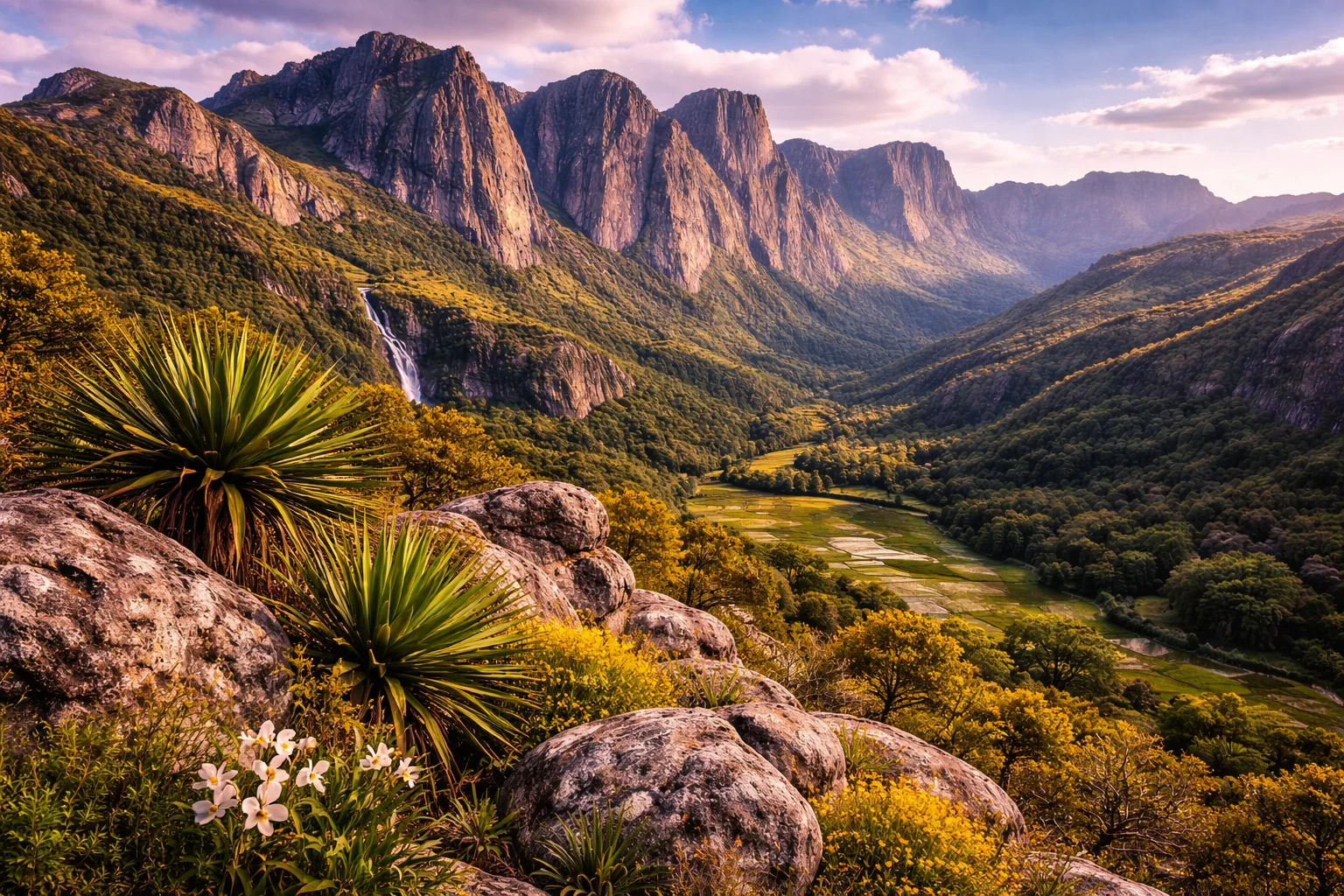
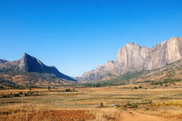
Hiking in Andringitra National Park in Madagascar takes you through dramatic granite mountains, high plateaus, and deep forested valleys. Trails climb through rugged landscapes toward peaks like Pic Boby, revealing sweeping views across Madagascar’s remote highlands. Along the way you pass waterfalls, rocky ridgelines, and unique plants and wildlife found nowhere else on Earth. With its striking rock formations, cool mountain air, and incredible biodiversity, hiking in Andringitra feels adventurous, wild, and truly unique.
Your adventure begins as you arrive in Madagascar, where transport will be arranged to collect you from the capital, Antananarivo. It’s well connected to Europe and Africa, making your journey smooth and hassle-free. We will start our journey to the mountains early morning on the first day as it’s a long drive to the mountains. We will make stops on the way and it’s a great way to see the local landscapes passing by. We ask you to arrive at least the day before and use the time to explore the city. If you’re arriving a day early, we can suggest excellent accommodation options to ensure a relaxed start to your journey.
For the duration of the trip, you’ll be based in Ambalavao, not far from the entrance to the Andringitra National Park. This means you won’t have to carry all your belongings from place to place, and after each day of hiking, you’ll return to the comfort of a warm shower and a cosy bed. Get ready for an unforgettable week exploring one of Africa’s most spectacular mountain landscapes.
Click for Route Map : 10 km 4–5 h ~600 m ●●●○○ — Moderate
This rewarding hike climbs from the lush Tsaranoro Valley up to the distinctive Caméleon (Chameleon) peak, so named for its reptilian silhouette against the skyline. The trail begins through shaded forest and transitions to open slopes and rocky ridgelines as you gain altitude.
You’ll pass through the “sacred forest” with its tombs and mossy boulders, then steadily ascend the mountain’s flank along a mix of footpaths and scrambly sections. At the summit you’re rewarded with sweeping views over the Tsaranoro massif, Andringitra range, and valley below.
The descent returns by the same route giving a different prespective. In favorable weather, the sunrise/sunset light accentuates the dramatic landscapes and towering rock walls.
Click for Route Map : 14 km 5–6 h ~800 m ●●●○○ — Challenging
This scenic and culturally significant route climbs from the village of Ambohimahamasina to the sacred peak of Ambondrombe, a mountain wrapped in local legend and mystery.
The path rises steadily from cultivated hillsides into high-altitude forest, shaded by bamboo and native trees. As the climb continues, the forest opens to grassy ridges with wide views over the valleys and highlands of the region.
Higher up, the trail becomes steeper and more rugged, crossing rocky outcrops and patches of dense vegetation before reaching the upper slopes of Ambondrombe at 1,936 m. From the summit, there are expansive views across the central highlands and, in clear weather, as far as the distant Andringitra massif.
The descent follows the same route back to Ambohimahamasina, with changing light and views offering a fresh perspective on this atmospheric and remote landscape.
Click for Route Map : 10 km 6 h ~600 m ●●●○○ — Moderate
This extended circular route explores the granite hills and dry forest of Anja Community Reserve, offering both rich wildlife encounters and expansive mountain views.
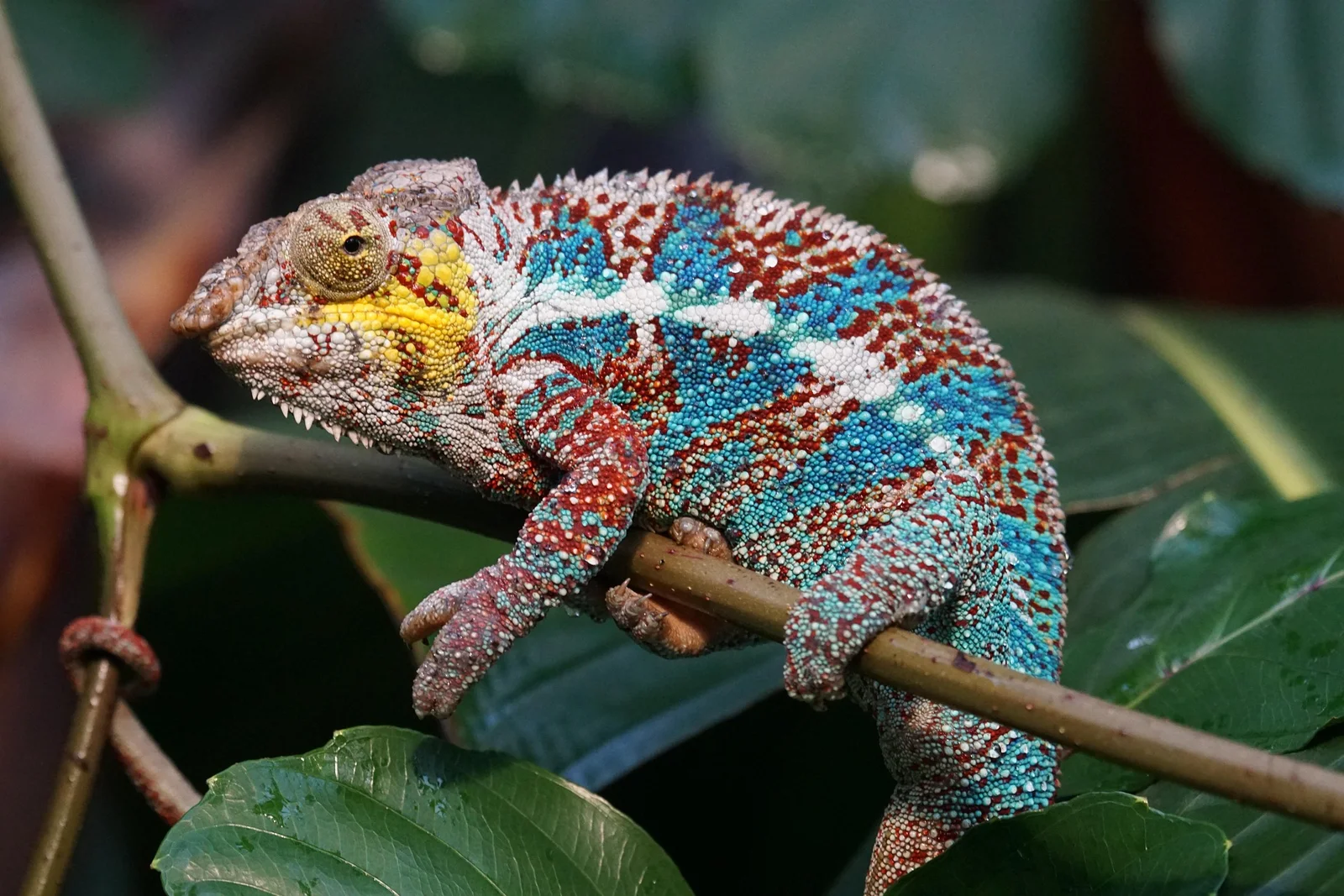
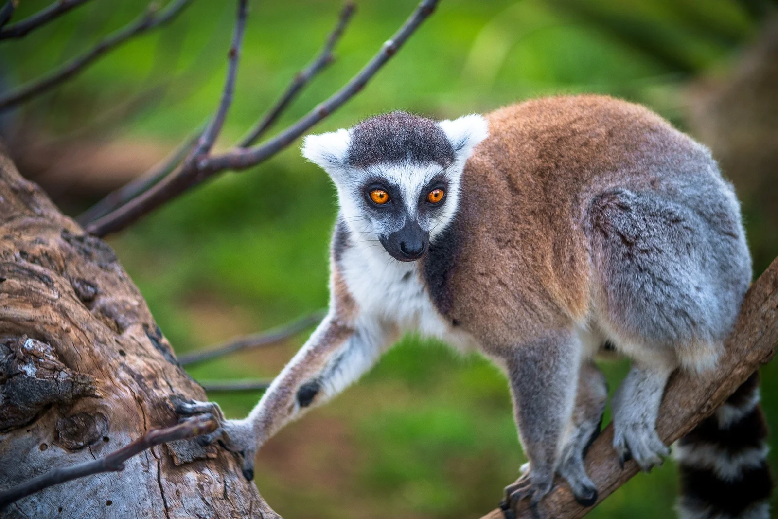
Starting from the reserve entrance near Ambalavao, the trail passes through forest inhabited by ring-tailed lemurs, chameleons, and diverse birdlife. The ascent follows rocky paths and open granite slopes, gradually gaining height above the valley floor.
As the route climbs toward the upper ridges, the vegetation thins and wide panoramas emerge over the Betsileo highlands, with the Andringitra massif rising in the distance. The summit area, at around 1,500 m, provides superb viewpoints across the granite domes and plains below.
The descent loops through lesser-visited sections of the reserve, crossing traditional farmland and small forest patches before returning to the entrance. With its mix of nature, culture, and scenery, this is one of the most rewarding moderate hikes in southern Madagascar.
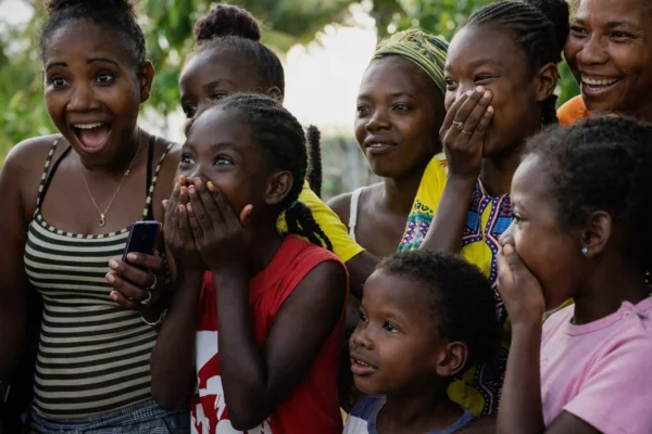
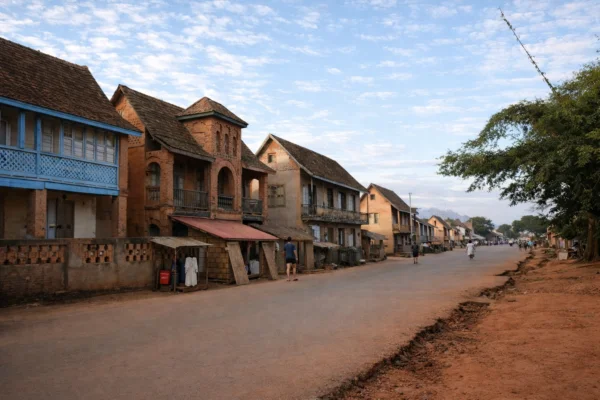
Time for a well earned rest! Ambalavao is a lively highland town known for its warm atmosphere, traditional Betsileo culture, and beautiful surroundings. It’s a great place to slow down and experience everyday Malagasy life. The Wednesday market is one of the most vibrant in the region, famous for its zebu cattle trading and colorful displays of produce, crafts, and fabrics. Visitors can explore small workshops where artisans make Antemoro paper, a centuries-old craft using tree bark and dried flowers, or browse local textile stalls for handwoven lambas and embroidery. The town’s architecture, with its carved wooden balconies and red earth houses, reflects the blend of highland and colonial influences. Just outside town, small villages welcome visitors to learn about rice cultivation and local wine production, while evening walks reveal stunning light over the surrounding granite hills. Ambalavao offers an authentic glimpse into the traditions, artistry, and rhythm of Madagascar’s rural highlands.

Click for Route Map : 10 km 6 h ~500 m ●●●○○ — Moderate
This rewarding full-day hike explores the lush community-managed forest near Ambohimahamasina, on the northern slopes of Andringitra National Park. The trail winds through varied habitats ranging from bamboo groves and dense woodland to open clearings with fine views of the surrounding granite peaks.
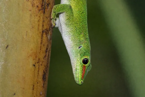
Local guides lead the way and help spot wildlife, including ring-tailed and red-fronted lemurs, as well as a variety of chameleons, orchids, and forest birds. The route follows old footpaths used by farmers and herders, climbing gradually through shaded forest before reaching higher ridges where the canopy opens and the air cools.
Lunch is taken at a natural viewpoint overlooking the Betsileo highlands before the path descends through secondary forest and small cultivated plots back to the village. The hike offers an ideal mix of nature, culture, and gentle adventure, showcasing the harmony between people and the landscape in this part of Madagascar.
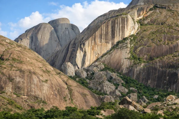
As the gorge comes into view, the cliffs grow steeper and the scenery more dramatic. Sheer rock walls plunge hundreds of metres, while narrow ridges offer some of the most impressive outlooks in the park. The sounds of distant waterfalls echo through the canyon, especially after rain.
Click for Route Map : 11 km 6 h ~450 m ●●●○○ — Moderate
This engaging full-day route explores the rich natural and cultural landscape of the Betsileo highlands, combining forest, farmland, and village life in a single experience.
The trail begins near the village and follows rural paths through rice terraces, vegetable plots, and bamboo groves, where local farmers can often be seen tending the fields. Gradually ascending into mixed forest, the route passes through areas where lemurs, chameleons, and colorful birds are frequently sighted. Local guides share stories about traditional land use, medicinal plants, and the region’s deep spiritual connection with the forest.
Higher up, viewpoints open across the patchwork of valleys and hills, dotted with red-earth houses and granite domes. The descent passes through small hamlets where visitors may be welcomed with a smile or an invitation to taste local produce.
Blending gentle hiking with authentic encounters, this trail offers a vivid glimpse of Betsileo rural life and the close relationship between people, wildlife, and the highland environment.
After an incredible week exploring the wild beauty of the Andingitra Mountains, it’s time to pack your bags and begin your journey onwards. Transport will be arranged to take you to Antananarivo. It’s recommended not to book a flight on the final day to give us time to get you back to the capital.
If you’re extending your stay, there are plenty of incredible places to explore beyond the mountains. We’d be happy to share recommendations to help you make the most of your time.
As you leave Ambavalao behind, you’ll take with you memories of dramatic peaks, incredible wildlife, and unforgettable adventures in one of Africa’s most breathtaking landscapes. Until next time!
What's Included
- Accommodation (Twin Room)
- Airport Transfers
- Expert Guided Hikes
- Breakfast
- Transport to and from Hikes
- Hiking Friends
Additional Info
Accommodation – Hotel Aux Bougainvillees, Ambalavao
Meeting Point – Maison d’hôtes The Citizen, Antananarivo
Nearest Airport – Ivato International Airport, Antananarivo
Airport Transfers – Taxi (40 mins, £10-20)
Transfer Details – The group transfer will leave Maison d’Hotes in Antananarivo at 05:00. We recommend landing the day before to give yourself time to make the transfer.
Journey time is around 11 hours from Antananarivo to Ambalavao. We will make plenty of stops for meals and toilets breaks and it also gives you opportunity to see more of Madagascar. The return to Maison d’Hotes will be at 05:00 on the final day arriving around 18:00. We recommend not booking your return flight until the following day.
Max Group Size – 12
Difficulty – On all our Trailmates trips you should have a good level of fitness. You don’t need to be an expert hiker but walks can be long with elevation. When possible we try to offer alternative options for those who want an easier day.
Dates & Prices
-
SaturdayApril 17, 2027SaturdayApril 24, 2027£695£62510% OffAvailable
-
SaturdayJuly 3, 2027SaturdayJuly 10, 2027£695£62510% OffAvailable
-
SaturdaySeptember 11, 2027SaturdaySeptember 18, 2027£695£62510% OffAvailable